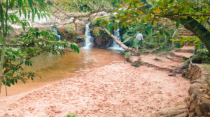
 LAS CUEVAS IS only 20km away from Samaipata but a visit to the waterfalls had been recommended. The campsite across the road wedges itself in the elbow of the hairpin as the road crosses the river. I pitched the tent as far from the roadside as I could, then wandered across to visit the falls.
Small and pretty, freshly cut grass and clearly marked paths to the red sandy beaches of the falls. The falls are all within half a kilometre (there are no caves.)
 A few people were enjoying the sun and the water. It was a pleasant enough visit but I would have preferred staying at Serena in hindsight. Sometimes a visit is worthwhile to extinguish the curiosity that is carried if ever an opportunity is missed.
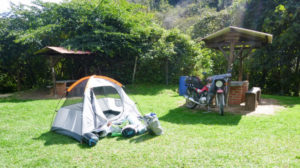
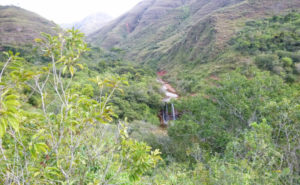
After the road crosses the river, it scales the hillsides on either side. There is no escaping the noise of the overnight truck’s bellowing exhaust brakes on the descent and the chugging and roaring gearshifts on the ascent.
I waited for the morning sun to dry the dew off the tent before packing away. Santa Cruz is less than 100km east, and my planned camp at Porongo lies at least 10km closer. I should make it in less than three hours, even on dirt tracks.
In the pale yellow light of a warm sunny day, I rattled over rocky dirt roads and rolled over dusty grey asphalt. Signs warned me of speed humps that were sometimes there, sometimes not. And speed humps sometimes produced themselves unannounced with their paint long worn away by tyres, sun and rain, and camouflaged in trail dust. I’d become wary of villages long ago as they almost guaranteed speed humps.
La Guardia hosted my junction to turn left toward Porongo, which happened to be the unsigned street thirty metres ahead of me from where I had stopped to check the maps.me satnav app. Perfecto.
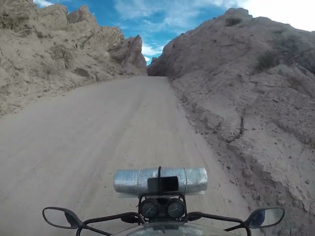
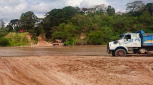 Surprise! The river crossing wasn’t what I imagined… no bridge. A wide ford across a shallow river over a rust-coloured sandy bed. The water flowed at a good jogging pace and the ripples suggested depths over knee deep. The distance across must have been at least a hundred metres and the chances of a deep channel along the way were greater than I was willing to risk with my laptop in the bags, phone in my pocket and my low slung exhaust pipe about a 30cm off the ground.
One of the things on my wishlist for buying a motorcycle was a high exhaust and air intake. In reality, even if I had that I still wouldn’t cross. Among all else, I didn’t want to get my feet wet.
Examining the map more closely, I could see the roads were coloured slightly duller on the handful of river crossings all the way down the river toward a single bridge, the Puente del Urubo, that linked Urubo to Santa Cruz. Porongo was less than 10km from where I sat on the river bank. I hung a U-turn and rejoined route 7, 25km to Santa Cruz. I’d get to see the city centre sooner than planned.
As is the way of cities, the traffic got heavier and slower the closer I got to the centre. Suddenly, a barricade of plastic drums across the road. I could see the dual carriageway continue toward the centre but all the minibuses were looping back to one of the inner ring roads. This time it was no blockade. It appeared to be a makeshift pedestrianised zone. Traffic lights were here managing the flow from the side street near the hairpin and the buses were looping and jostling across the outbound traffic to get to an extended bus stop parade. Obviously, there is no clue of this on the app and I picked up the diversion on one of the middle ring roads.
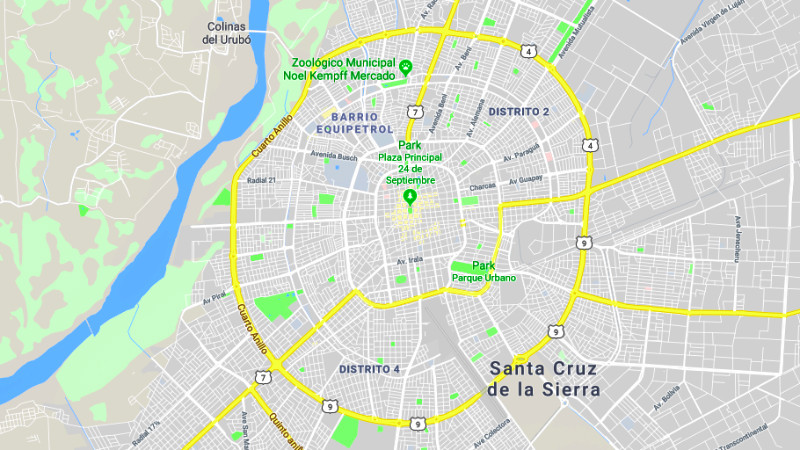 If you imagine the city’s road plan as a giant spider web of four concentric rings, and spokes radiating out from the centre, that’s roughly it with grid sections cut and pasted here and there. The result is, the longer you stay on a road, the less likely you are of knowing where you are and which direction you are facing. The Sun had moved my shadow from left to right. Stopping to check the map, I found I’d gone from the 9 o’clock position to the 4 o’ clock position already. I was travelling anticlockwise around the second to inner road and wanted to turn left across the traffic. Junction after junction was signed “no left turn” and I gave up trying to see the centre and, instead, aimed for the bridge back at about the 10 o’clock position to Santa Cruz. I was tired of the urban battle with the taxis and buses, it was getting late and I hadn’t yet established my campsite.
I guessed correctly, between the thickening traffic, the anonymous-looking, unsigned turning to the bridge and had joyfully overcome the mighty shallows of the Rio Pirai. Legend has it that the bridge was built privately by an 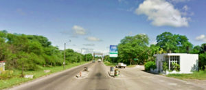 entrepreneur who set up toll gates to recoupe the ten million US dollars he had invested. Apparently, the government told him he couldn’t do that and the crossing had to be free of charge. As a result, the man killed himself and the remains of the toll gates lay inactive, becoming his personal tragic memorial each time I passed. Even more bizarre is the number of government tollgates along the half-built highways across Bolivia. The logic of Latin bureaucracy eludes me…
Another confident route mapped out on the maps.me app took me on a cross-country scar between gigantic commercial sites along a rutted grassland strip, littered with tyres and fly-tipped rubbish. But from then on it was plain sailing along a smooth white concrete ribbon into Porongo.
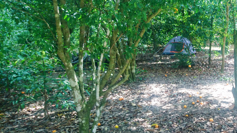
Morgante boasted Italian food on iOverlander and the only clue to its location in this physical world was a wooden ‘Pizza’ sign hanging near the gate. In this respect, Maps.me had the location pinpointed. The owner’s name was Giulio but he wasn’t there. His landlord was though, harvesting tangerines from the orchard shading the site from the sun. Jose, the landlord, knew nothing of Morgante and could not understand my poor Spanish but he recognised Giulio’s name in the iOverlander app I was waving around in sign language. and he gave him a call.
Giulio explained he was closed due to recent heavy rain and wasn’t taking guests. My fuel gauge was now nudging empty from the unexpected extra mileage. I explained I only wanted to pitch a tent and then was happy to let me stay, for free. One of the attractions here was WiFi but there was none.
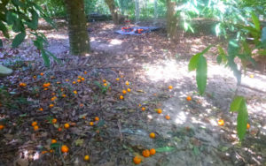 Today was meant to be an easy jaunt but turned out to be an unexpectedly tough battle on unfamiliar city web of streets with unpredictable traffic, with a 60km detour that took my fuel gauge down to E. I selected a flat area beneath the tangerine trees to put up the tent. The sun was somewhere near the horizon, out of sight behind the tree-tops and I was glad I didn’t have to search for another campsite using what was left of the day and my fuel.

https://waterfallmagazine.com
Hi there, I would like to subscribe for this weblog to obtain latest
updates, so where can i do it please assist.
Hi Ramon
I’ve just added a plugin for that so you should get the option for notifications the next time you visit.
Thanks
Paul
I’ve added a button for notifications now. let me know if it doesn’t work. Another post comes later today.